Development for OPT of a suite of tools for managing OPT's optical fiber telecommunications network.
Context
OPT-NC developed in its GIS a specific data model to manage its ultra-high-speed (UHS) optical fiber network.
To facilitate its use and multiply the efficiency of its teams, the operator needed to deploy a coherent set of tools (desktop, web, mobile) based on its ArcGIS Enterprise GIS portal.
These tools were to support teams from design through to field deployment and exploitation of the UHS network.
Solution Implemented
MAGIS developed a suite of tools adapted to different business needs, all integrated into OPT’s GIS ecosystem.
Desktop Tools (ArcGIS Pro)
- VBNet Extensions (addin): assisted connection entry, automatic filling of nomenclatures and civil engineering information, optical route generation…
- Python Toolbox automating time-consuming operations:
- Data quality reports
- Material inventories
- Automated fiber and connection entry during design
- Cartographic deliverable generation
Mobile Tools
- Field Maps project configuration for field data collection and network consultation on the go
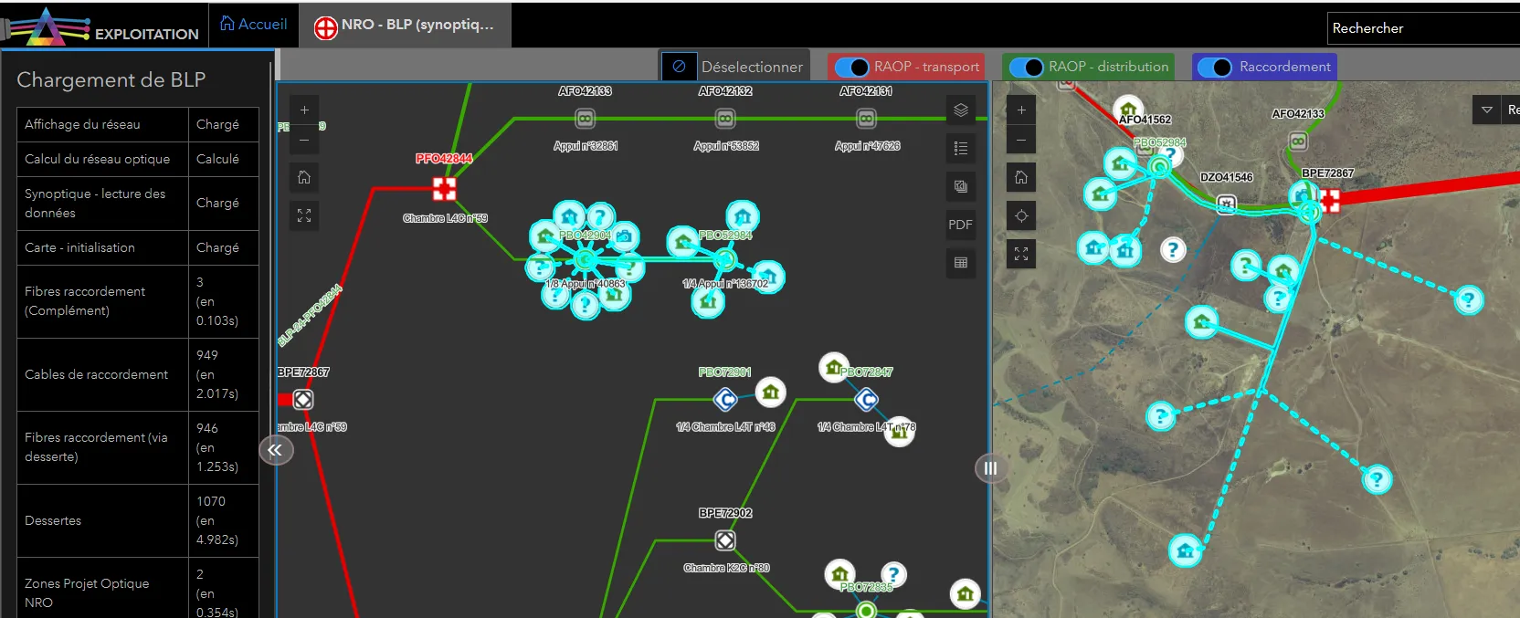
Offline-first web application for network exploration
Designed particularly for field teams, this TypeScript application enables consultation and navigation within the network across different views:
- Map view: location and geographic navigation
- Schematic view: schematic representation of the network
- Splicing plans: detail of connections in each equipment
- Optical route: complete traceability of a fiber from the central office to subscribers
Technical Architecture
- ArcGIS Enterprise 10.9.1 platform hosted at OPT
- VBNet extensions and Python toolboxes for ArcGIS Pro
- Web application in TypeScript with Esri JavaScript API
- Offline-first architecture to guarantee performance and field availability
Results & Key Figures
Network design and in particular the predictive management of fiber connections is much faster
Data is more reliable and traceability is ensured from the central office to subscribers
The tools developed enabled:
- Significantly reduced design and entry times
- Improved data quality on the network
- Facilitated field team operations