Services
GIS for institutions and territories
Design and deployment of ArcGIS Enterprise portals for governments and provinces. Multi-profile access, data publication and web maps.
Biodiversity monitoring, marine protected areas, forest and agricultural inventories. Field data cross-referenced with satellite imagery.
ArcGIS Hub platforms, open data publication, citizen-facing applications and development indicators.
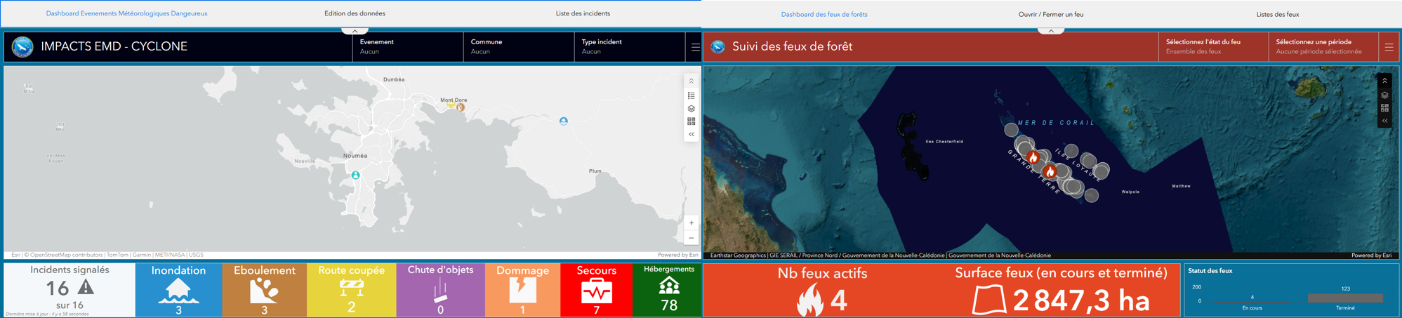
GIS for natural hazard management (cyclones, flooding), emergency coordination and field monitoring.
Case studies
Territory projects
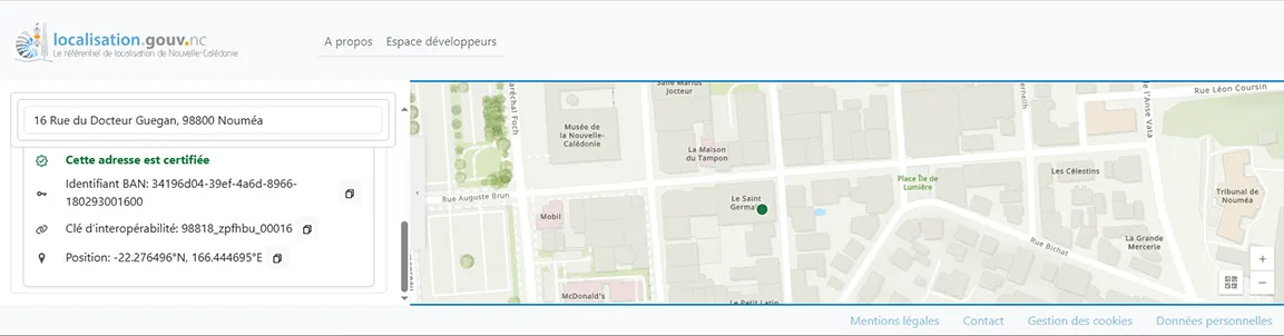
Location API — Sovereign geocoding for NC
2025DINUM — Government of New Caledonia
Duration: 7 months
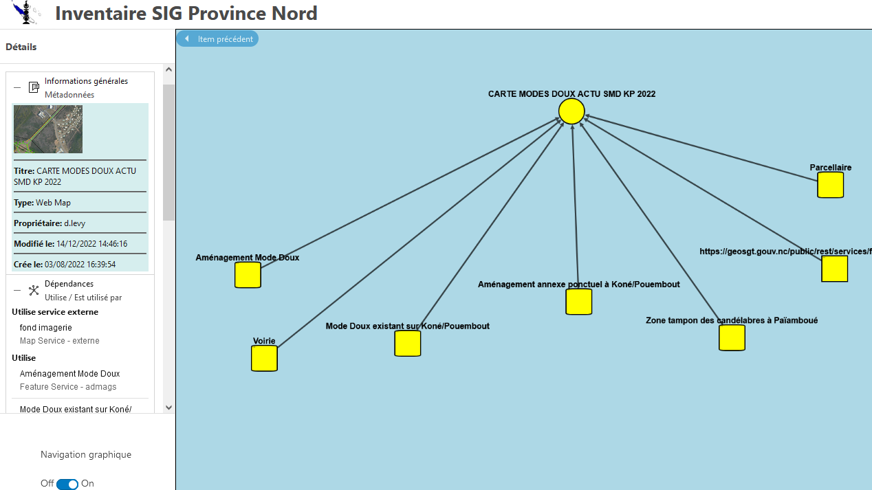
ArcGIS Portal inventory & supervision
2024Province Nord — Information Enhancement Service
Duration: 3 months + 1 month
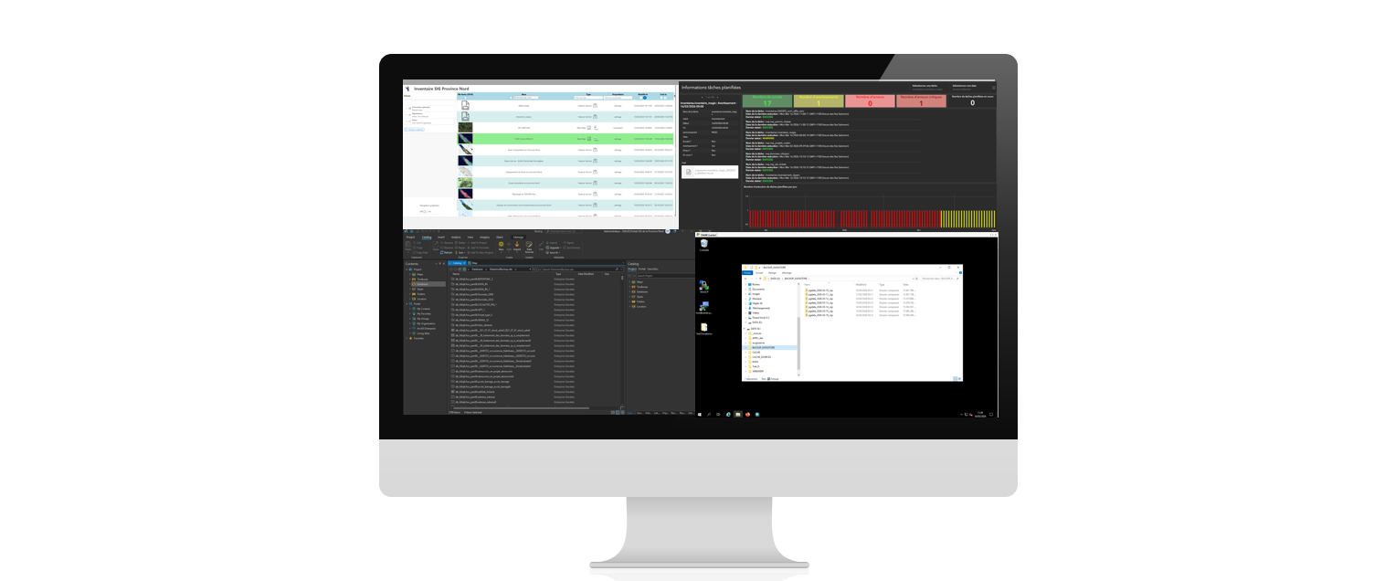
ArcGIS Portal Supervision, Automation and Administration
2024Province Nord - New-Caledonia
Duration: 3 months + 1 month + 1month

Environmental Observatory — Marine Mammal Observations
2023Direction de l'Environnement — French Polynesia
Duration: 7 months
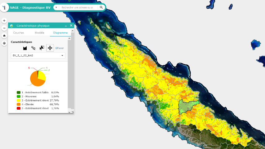
Watershed Assessment
2023North Province — Water Management and Planning Department
Duration: 12 months
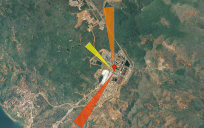

TOHORĀ TURE — Whale Watching Supervision
2023Direction de l'Environnement — French Polynesia
Duration: 9 months