Areas of expertise
What we do
Water, electricity and fibre-optic networks, airports, maritime surveillance, autonomous port, mining, local authorities: MAGIS supports critical operators in upgrading their geographic information systems.
Transport
Aviation · Maritime · Road
Aeronautical constraints, airport databases, maritime surveillance, AIS, vessel detection, road database, route resolution.
Discover →
Utilities
Water · Electricity · Telecoms
ArcGIS Utility Network, ArcGIS Enterprise, CMMS integration, GIS-ADMS interoperability, automation, real-time, maintenance.
Discover →
Land & Environment
Institutions · Mining · Environment
Institutional mapping portals, environment, Open Data, mobile field applications and crisis management.
Discover →
Recent projects
Selected case studies
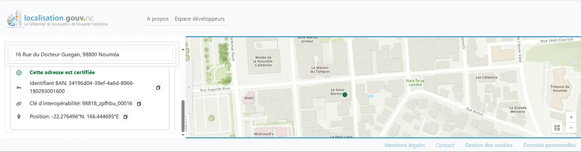
Location API — Sovereign geocoding for NC
2025DINUM — Government of New Caledonia
Duration: 7 months
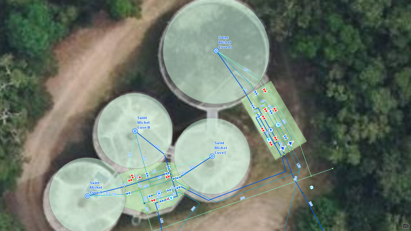
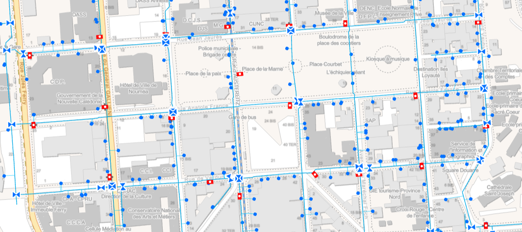
CART'EAU NC — Water and sanitation network
2025Calédonienne des Eaux (Suez)
Duration: Ongoing
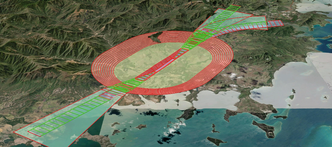
DAC French Polynesia — Airports Database
2025Direction de l'Aviation Civile — French Polynesia
Duration: 6 months
Partnerships & certifications
A certified level of expertise
Innovation programme
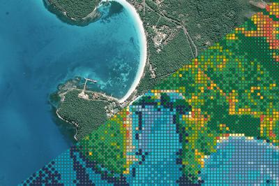
MARIS — Maritime Awareness and Response Information System
MARIS is an innovation programme led by MAGIS to develop a multi-source maritime surveillance platform for island territories and large exclusive economic zones. The system fuses AIS, VMS, optical and radar satellite imagery, IoT sensors and radio-frequency signals, with AI analysis capabilities and automatic satellite observation tasking, to produce an enriched operational maritime picture. A first version is already in use for the supervision of the Coral Sea Natural Park (1.3 million km²).
Dedicated MARIS website coming soon