Multi-source maritime surveillance platform (AIS, VMS, radar, optical and radar satellite imagery) enabling visualization, analysis and monitoring of maritime traffic in the New Caledonian EEZ.
Context
For its Coral Sea Natural Park surveillance system (S²P), the government wanted to equip itself with an IT platform capable of consolidating, consulting and analyzing multiple data sources from public programs (European satellite program Copernicus), commercial providers (AIS, Optical imagery) or government programs (VMS, Park radar sentinels).
Solution
MAGIS developed an IT system to centralize all these data sources in real-time and then analyze them to enable the Park to monitor maritime activity and be alerted in case of suspicious behavior.
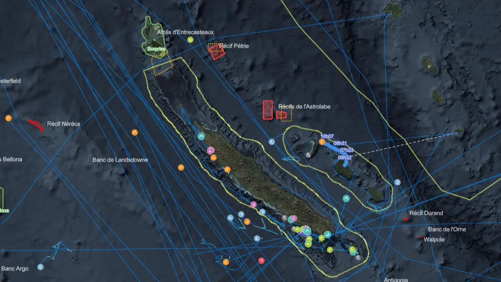
The system integrates theoretical maritime traffic from AIS (Automatic Identification System) data integration from ships. This raw data is enriched and analyzed to detect abnormal or problematic behaviors (entry or exit from sensitive areas, fishing behavior, trajectory approaching dangerous area, transshipment…)
Multiple ship detection sources are automatically integrated into the system and enable, through correlation with the theoretical AIS situation, to highlight potentially illegitimate vessels:
- VMS (Vessel Monitoring System): monitoring system for New Caledonian fishing vessels
- Park Sentinels: system developed by the park to analyze on-board radar data from partner vessels
- Satellite data
- Optical (Copernicus Sentinel-2)
- Radar (Copernicus Sentinel-1)
- Radio-frequency (Unseenlabs)
Finally, the system can, in some cases, automatically order and acquire commercial optical imagery (BlackSky) available within a few hours to resolve suspicions.