Operational Excellence for Water Services: Calédonienne des Eaux upgrades to ArcGIS Utility Network.
To meet the growing demands of modern operations, Calédonienne des Eaux initiated a major overhaul of its GIS. The aging systems were no longer sufficient: the goal was to have a resolutely business-oriented, high-performance solution capable of seamlessly interfacing with critical IT systems, such as customer management and CMMS (Computerized Maintenance Management System).
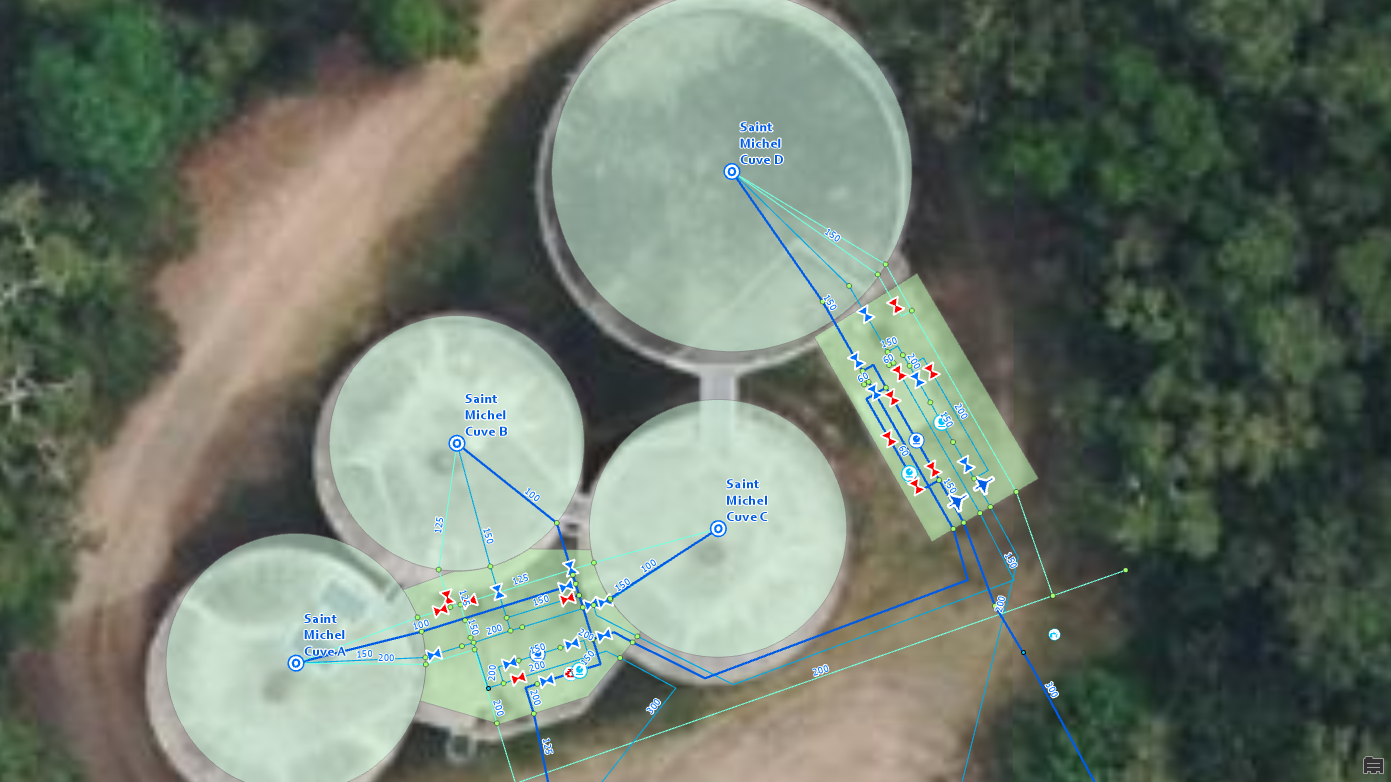
Our Solution: The Power of ArcGIS Utility Network
Leveraging our Network Management Specialty certification, our engineers orchestrated the complex migration of existing data and its integration into the state-of-the-art ArcGIS Utility Network model.
We worked hand-in-hand with the business teams to deploy advanced features that transform the daily work of operators:
-
Network intelligence: Implementation of strict topology rules and graph traversal (to quickly simulate the impact of a water outage, for example).
-
Interfaces with third-party IT systems like customer management, to quickly alert sensitive customers during network interventions.
-
Field-to-office continuity: Integration of mobility solutions so that field agents are connected in real-time to the central repository.
Thus, we radically modernized our client’s management of drinking water and sanitation networks.
Beyond the technological aspects, the entire work organization has been enhanced. The flexibility of this new architecture allows for rethinking internal processes and optimizing application interoperability. The GIS is no longer an isolated tool; it now feeds the entire information system of Calédonienne des Eaux, ensuring increased operational efficiency for the benefit of New Caledonian users.