Case studies
Utilities, transport and territories — filter by tag to explore our projects.
Utilities
Utility projects
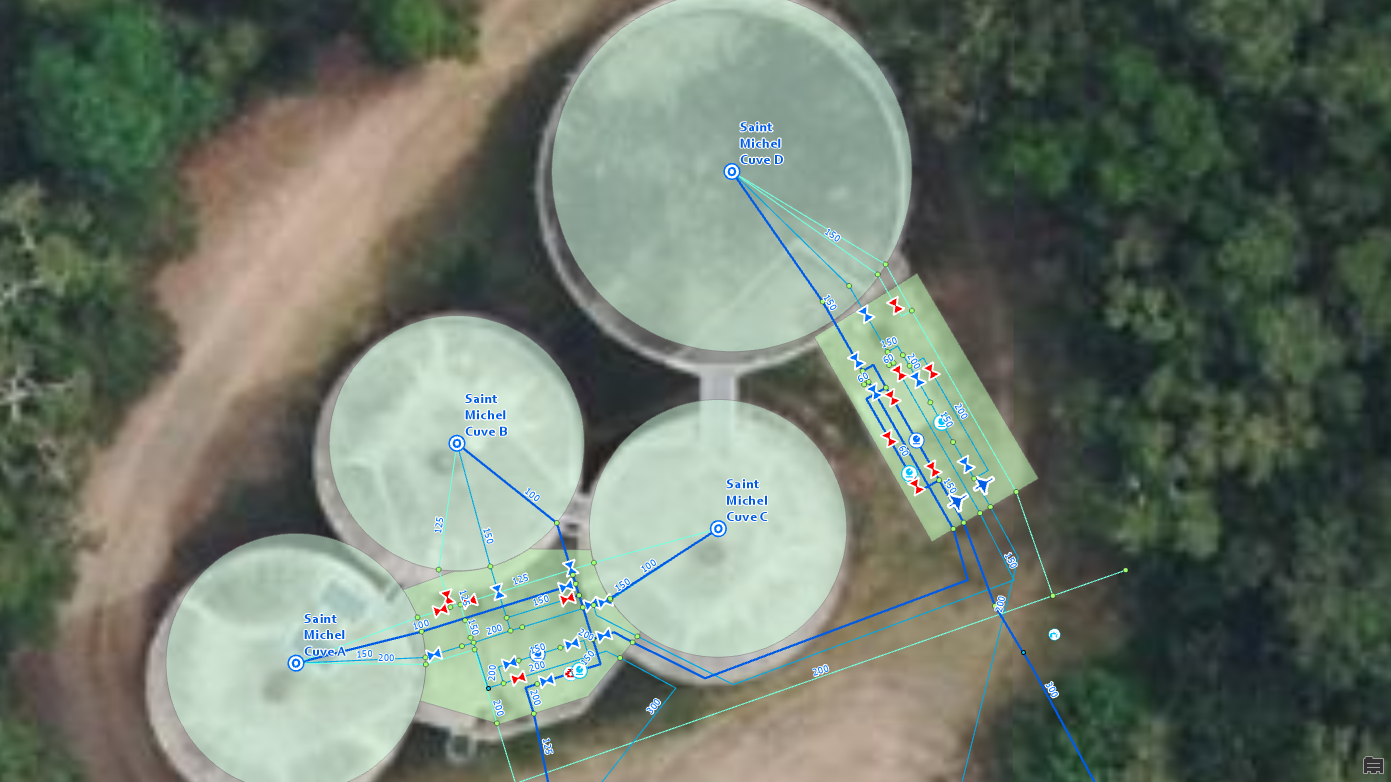
CART'EAU NC — Water and sanitation network
2025Calédonienne des Eaux (Suez)
Operational Excellence for Water Services: Calédonienne des Eaux upgrades to ArcGIS Utility Network.
Keywords : ArcGIS Utility Network · ArcGIS Enterprise · PostgreSQL · CMMS · System Integration · Experience Builder
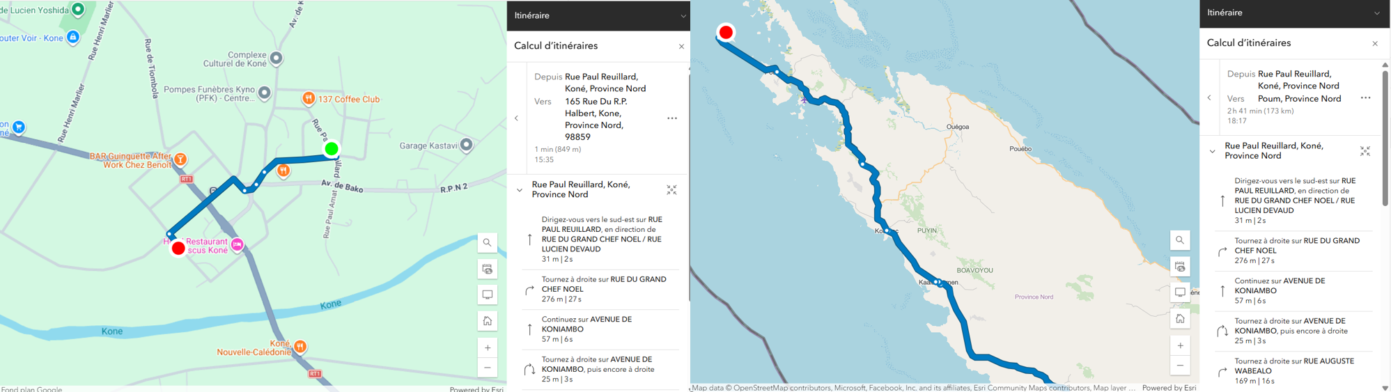
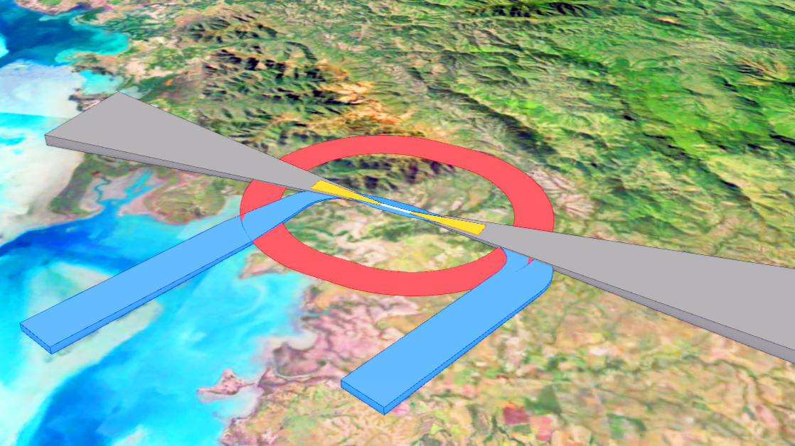
Development of a Routing Service.
2025Northern Province - New Caledonia
Deployment of a specialized multimodal routing service for the Northern Province.
Keywords : ArcGIS Pro · Network Analyst · ArcGIS Enterprise · Routing Service · NetworkDataset · Experience Builder · ArcGIS Server
Project Chloé — GIS/ADMS supervision interface
2024EEC (Engie)
Application connecting EEC's GIS to its ADMS system to feed near real-time supervision of the electricity distribution network.
Keywords : JavaScript · Python · CIM XML · SI integration · Supervision · Agile
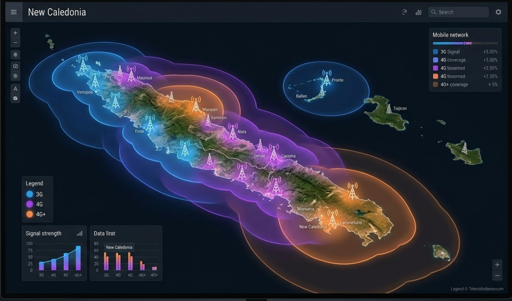
Mobile coverage
2024Office des Postes et Télécommunications (OPT-NC)
Modeling and publication of 3G, 4G and 4G+ mobile coverage across New Caledonia using advanced geospatial analysis after each network update.
Keywords : Python · ArcGIS Pro · ArcGIS Online · 3G/4G · Telecommunications
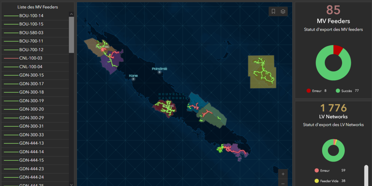
TIGRE — Geographic Information Processing for Electrical Networks
2024EEC (Engie)
Full migration of New Caledonia's electricity distribution network to ArcGIS Utility Network. Topology, graph traversal, field mobility and network diagrams.
Keywords : ArcGIS Utility Network · ArcGIS Enterprise · ADMS · Experience Builder · Add-In · C#
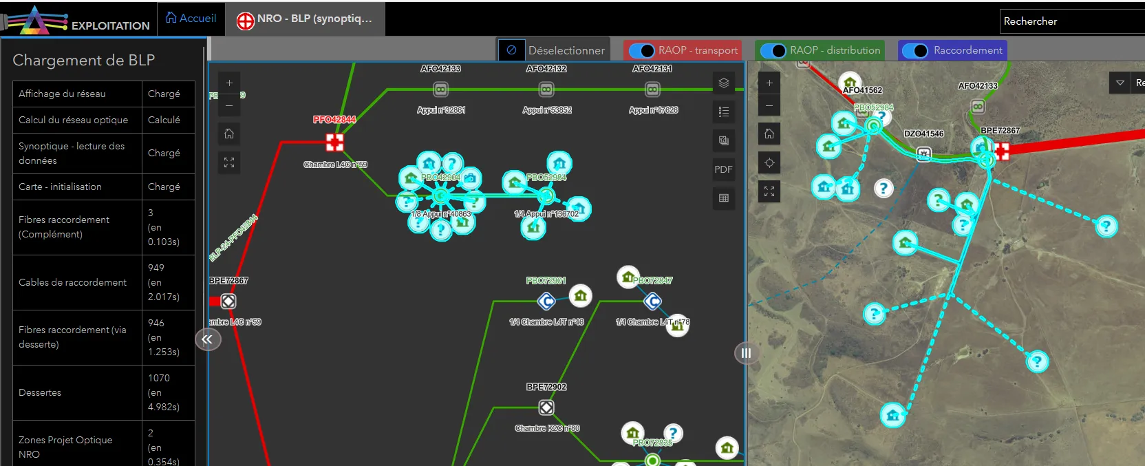
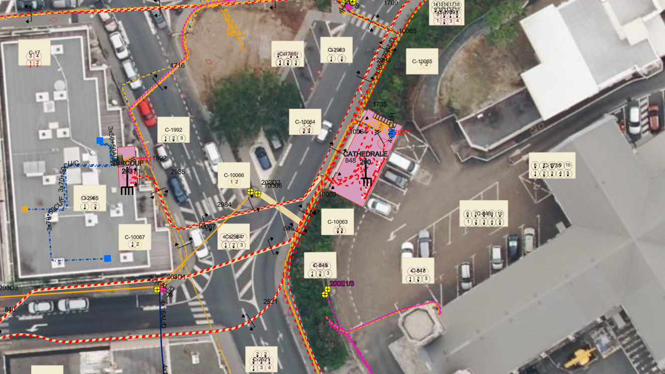
PRISME - Development of optical fiber network management tools for OPT
2023Office des Postes et Télécommunications (OPT-NC)
Development for OPT of a suite of tools for managing OPT's optical fiber telecommunications network.
Keywords : ArcGIS · Python · VB.net · Esri JavaScript API
Transport
Transport projects
DAC French Polynesia — Airports Database
2025Direction de l'Aviation Civile — French Polynesia
Centralised asset register on ArcGIS Aviation model for 48 aerodromes, with automatic 3D obstacle detection.
Keywords : ArcGIS Aviation · ArcGIS Pro · 3D Analyst · ArcGIS Online · Aviation safety · Experience Builder
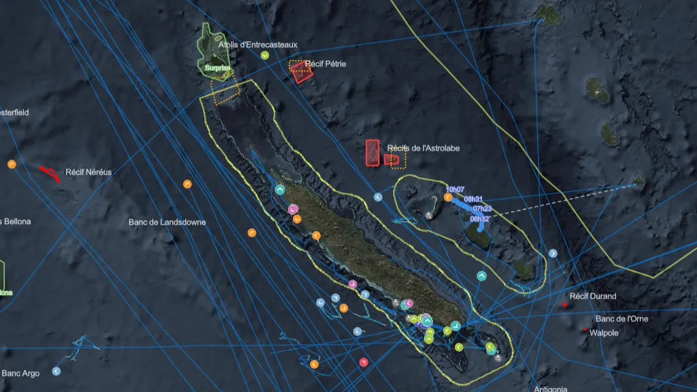
S²P — Surveillance of the Coral Sea Natural Park
2024Coral Sea Natural Park — Government NC
Multi-source maritime surveillance platform (AIS, VMS, radar, optical and radar satellite imagery) enabling visualization, analysis and monitoring of maritime traffic in the New Caledonian EEZ.
Keywords : Real-time · ArcGIS JS API · PostgreSQL · AWS · Satellite · AI · AIS/VMS · Dashboard
SERVAU — Aeronautical constraint surfaces 3D
2023Direction de l'Aviation Civile (DAC-NC)
Tool for automated generation of 3D regulatory landing/takeoff surfaces and volumes to update aeronautical constraint plans.
Keywords : ArcGIS Pro · 3D Analyst · Aviation Safety · ICAO · OIS · Add-In · C#
Land & Environment
Land & environment projects
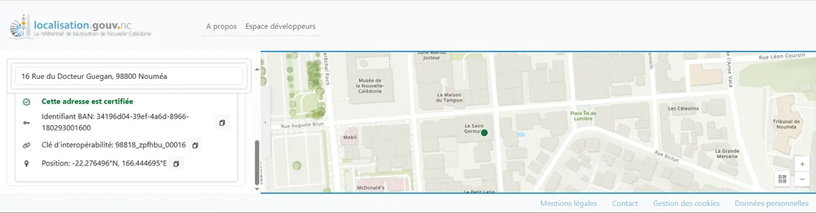
Location API — Sovereign geocoding for NC
2025DINUM — Government of New Caledonia
Deployment of a sovereign location reference API for New Caledonia: open API, public website and ESRI-compatible geocoder, integrating cadastre, addresses and POIs on the BAN model.
Keywords : Docker · Python · React · TypeScript · Open Data · Geocoding · API · Interoperability · Agile
Brick my Map !
2025CNES
Brick map assembly workshop
Keywords : Satellite · ArcGIS Pro · StoryMaps · CNES
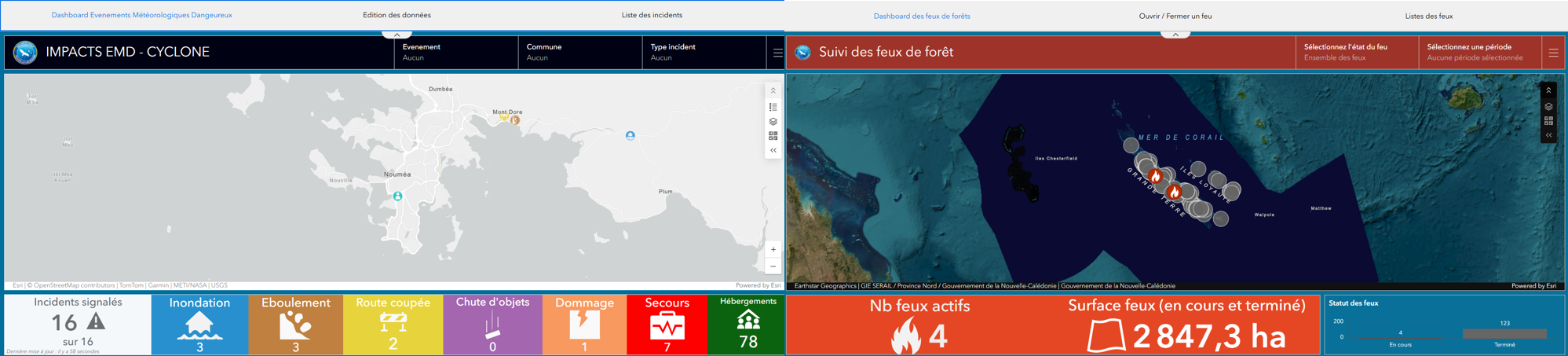
Monitoring of cyclones and wildfires.
2024DSCGR
A suite of decision-support tools for managing hazardous weather events and wildfires.
Keywords : Monitoring · QuickCapture · Dashboard
ArcGIS Portal inventory & supervision
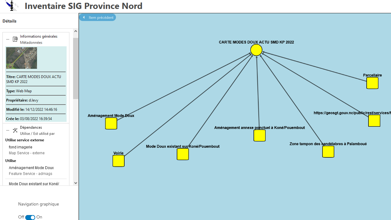
2024Province Nord — Information Enhancement Service
Web interface for inventorying and visualising dependencies among 16,964 items in the provincial GIS portal, with a scheduled-task supervision dashboard.
Keywords : JavaScript · Python · ArcGIS Enterprise · Supervision · Dashboard
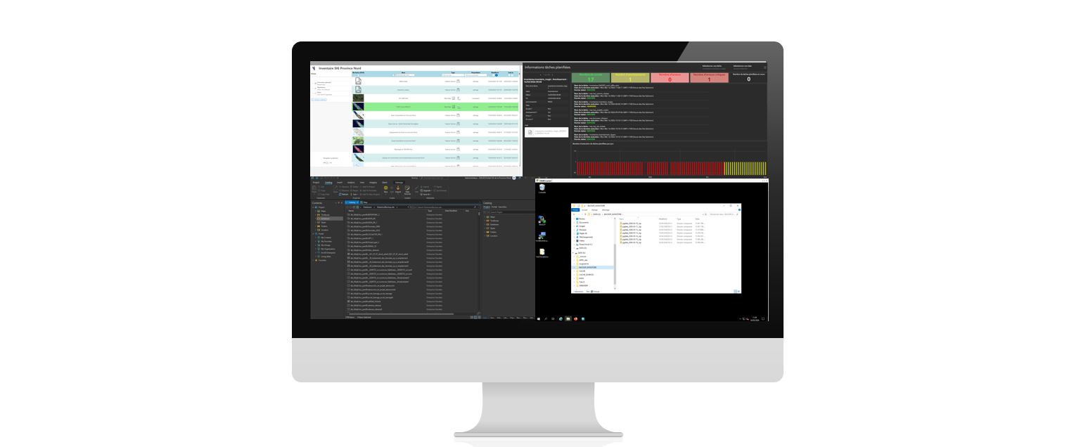
ArcGIS Portal Supervision, Automation and Administration
2024Province Nord - New-Caledonia
Web interface for inventorying and visualising dependencies among 16,964 items in the provincial GIS portal, scheduled-task supervision dashboard, backup/restore system for GIS databases
Keywords : Python · JavaScript · Svelte · PostgreSQL

Environmental Observatory — Marine Mammal Observations
2023Direction de l'Environnement — French Polynesia
Development of a geolocated mobile application allowing field users to record marine mammal observations in French Polynesia through an intelligent form connected to an interactive map.
Keywords : JavaScript · Angular · Java · ArcGIS · RGPD
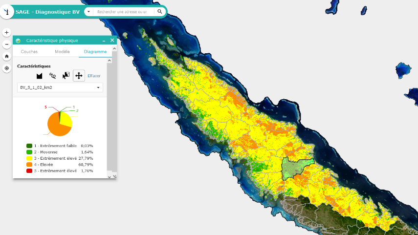
Watershed Assessment
2023North Province — Water Management and Planning Department
Watershed Assessment and Preservation: A Unique Geo-Decision Tool for New Caledonia's North Province.
Keywords : Multi-criteria analysis · Hydrological network · Suitability Modeler · Model Builder
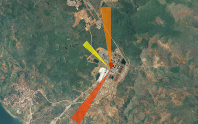
Wind Rose
2023Prony Resources
Real-time wind rose to alert Prony agents to potential chemical exposure risks.
Keywords : Python · Agile · Meteorology

TOHORĀ TURE — Whale Watching Supervision
2023Direction de l'Environnement — French Polynesia
Mobile solution for real-time monitoring and supervision of whale watching operators in French Polynesia to ensure compliance with cetacean protection regulations.
Keywords : React Native · Mobility · Supervision · RGPD